Trail Walking Wangenbourg-Engenthal - Le donjon du Wangenbourg - Photo

Le donjon du Wangenbourg

© OpenStreetMap contributors
Length
Length
15.9 km
Max alt
Max alt
521 m
Uphill gradient
Uphill gradient
399 m
Km-Effort
Km-Effort  
21 km
Min alt
Min alt
328 m
Downhill gradient
Downhill gradient
399 m
Boucle
Boucle
Yes
Creation date :
2022-04-15 08:24:00.051
Updated on :
2022-04-16 08:30:59.855

(1 Reviews)

Walking
Walking
4h32
Difficulty : Medium

Scan this QR Code to open this trail in the SityTrail application

FREE GPS app for hiking

Logo SityTrail SityTrail

IGN / Geographical institutes

Download SityTrail from the App Store Download SityTrail from Google Play

Logo SityTrail SityTrail Plus

The world is yours!

Download SityTrail from the App Store Download SityTrail from Google Play Download SityTrail on Huawei AppGallery

About

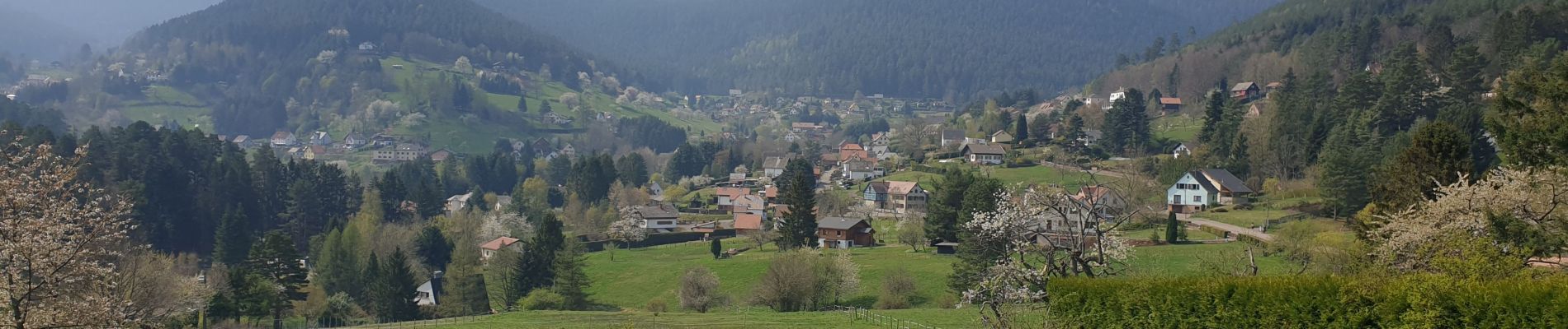
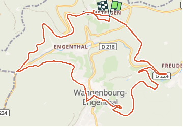
Trail Walking of 15.9 km to be discovered at Grand Est, Bas-Rhin, Wangenbourg-Engenthal. This trail is proposed by VacheKiri67.

Description

Faite le 15/04/2022. Au départ d'Obersteigen.
D'après "Passion Vosges : Châteaux forts d'Alsace - 10 : Le donjon du Wangenbourg". Durée indiquée pour le circuit : 4h30.

Elevation profile

Photos

36 photos in total. Please click on a photo to see them all in the gallery.

Positioning

Country:
France
Region :
Grand Est
Department/Province :
Bas-Rhin
Municipality :
Wangenbourg-Engenthal
Location:
Unknown
Start:(UTM)
375604 ; 5388930 (32U) N.

Comments

Please log in to post a review or rate the element


Close
My subscriptions