


signy l'abbaye.2022.04.16

trusgnachjf
User

Length
18.1 km

Max alt
236 m

Uphill gradient
326 m
Km-Effort
22 km

Min alt
138 m

Downhill gradient
321 m
Boucle
Yes
Creation date :
2022-04-16 07:59:06.924
Updated on :
2022-04-16 13:50:52.771
5h50
Difficulty : Very difficult

FREE GPS app for hiking
 SityTrail
IGN / Geographical institutes
SityTrail Plus
The world is yours!
About
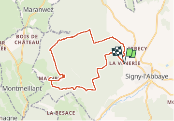
Trail Walking of 18.1 km to be discovered at Grand Est, Ardennes, Signy-l'Abbaye. This trail is proposed by trusgnachjf.
Positioning
Country:
France
Region :
Grand Est
Department/Province :
Ardennes
Municipality :
Signy-l'Abbaye
Location:
Unknown
Start:(Dec)
Start:(UTM)
601176 ; 5506615 (31U) N.
Comments