Trail Walking Digne-les-Bains - Le Cousson - Photo
 Marco05
Marco05

User

© OpenStreetMap contributors
Length
Length
15.4 km
Max alt
Max alt
1499 m
Uphill gradient
Uphill gradient
1040 m
Km-Effort
Km-Effort  
29 km
Min alt
Min alt
627 m
Downhill gradient
Downhill gradient
1042 m
Boucle
Boucle
Yes
Creation date :
2022-04-17 16:23:09.9
Updated on :
2022-11-01 12:53:43.207

(1 Reviews)

Walking
Walking
6h39
Difficulty : Difficult

Scan this QR Code to open this trail in the SityTrail application

FREE GPS app for hiking

Logo SityTrail SityTrail

IGN / Geographical institutes

Download SityTrail from the App Store Download SityTrail from Google Play

Logo SityTrail SityTrail World

The world is yours!

Download SityTrail from the App Store Download SityTrail from Google Play Download SityTrail on Huawei AppGallery

About

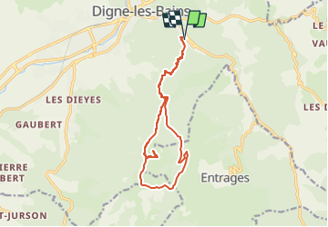
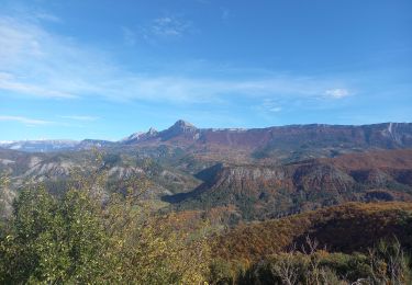
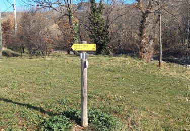
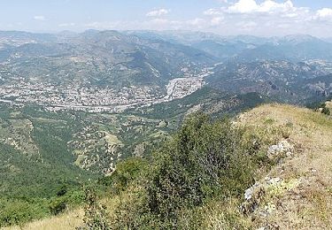
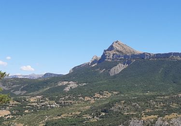
Trail Walking of 15.4 km to be discovered at Provence-Alpes-Côte d'Azur, Alpes-de-Haute-Provence, Digne-les-Bains. This trail is proposed by Marco05.

Description

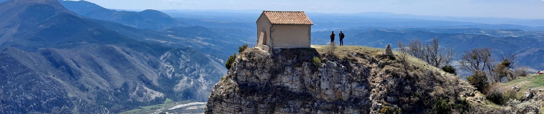
Sommet au sud de Digne-les-Bains.
Pas de difficultés techniques, mais condition physique obligatoire, car la randonnée est assez longue.

Elevation profile

Photos

Positioning

Country:
France
Region :
Provence-Alpes-Côte d'Azur
Department/Province :
Alpes-de-Haute-Provence
Municipality :
Digne-les-Bains
Location:
Unknown
Start:(UTM)
279955 ; 4884889 (32T) N.

Comments

Please log in to post a review or rate the element


Trails nearby

Trail Walking Digne-les-Bains - Autour de Courbons - Digne les Bains - Photo
Walking
tracegps

Walking

Medium
(1)
Digne-les-Bains, Provence-Alpes-Côte d'Azur, Alpes-de-Haute-Provence, France
12.6 km | 18.4 km-effort
5h 0min
Yes
Trail Walking Digne-les-Bains - 65bis-Digne- Cousson N et S- Caramantran- Digne  - Photo
Walking
dumotier

Walking

Medium
(1)
Digne-les-Bains, Provence-Alpes-Côte d'Azur, Alpes-de-Haute-Provence, France
17.4 km | 32 km-effort
3h 49min
Yes
Trail Mountain bike Digne-les-Bains - Terres Noires 2011 (50km) - Photo
Mountain bike
tracegps

Mountain bike

Difficult
(2)
Digne-les-Bains, Provence-Alpes-Côte d'Azur, Alpes-de-Haute-Provence, France
46 km | 63 km-effort
5h 0min
Yes
Trail Walking Digne-les-Bains - Chapelle St Pancrace 18.11.23 - Photo
Walking
fredetpascale

Walking

Easy
Digne-les-Bains, Provence-Alpes-Côte d'Azur, Alpes-de-Haute-Provence, France
5.2 km | 8.3 km-effort
1h 50min
Yes
Trail Walking Digne-les-Bains - Rando Col de Peipin Courbons - Photo
Walking
Marchopier

Walking

Medium
Digne-les-Bains, Provence-Alpes-Côte d'Azur, Alpes-de-Haute-Provence, France
18.5 km | 27 km-effort
5h 55min
Yes
Trail On foot Entrages - Le Sommet du Cousson - Photo
On foot
PRO

On foot

Medium
Entrages, Provence-Alpes-Côte d'Azur, Alpes-de-Haute-Provence, France
11.8 km | 21 km-effort
4h 50min
Yes
Trail Walking Marcoux - DIGNE . LES ROBINES DU BANASTRE  n ol - Photo
Walking
RobinMicheline

Walking

Easy
Marcoux, Provence-Alpes-Côte d'Azur, Alpes-de-Haute-Provence, France
11.4 km | 17.2 km-effort
3h 27min
Yes
Trail Walking Digne-les-Bains - ENTRAGES Tour et crête du Feston o s l - Photo
Walking
RobinMicheline

Walking

Medium
Digne-les-Bains, Provence-Alpes-Côte d'Azur, Alpes-de-Haute-Provence, France
12.7 km | 18.7 km-effort
4h 13min
Yes
Trail Motorbike Digne-les-Bains - GTA 2018 - ETAPE 8 - Photo
Motorbike
lagardienne

Motorbike

Easy
Digne-les-Bains, Provence-Alpes-Côte d'Azur, Alpes-de-Haute-Provence, France
247 km | 308 km-effort
10h 20min
No


Close
My subscriptions