


GRAND COLOMBIER: SUR LYAND - CHARBEMENES par les crêtes - COLOMBIER - RETOUR PAR VALLON D'ARVIERES

djeepee74
User
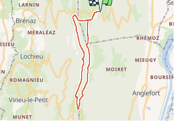

Length
14.5 km

Max alt
1512 m

Uphill gradient
591 m
Km-Effort
22 km

Min alt
1146 m

Downhill gradient
597 m
Boucle
Yes
Creation date :
2022-04-18 07:43:00.7
Updated on :
2022-04-18 16:54:06.51
4h30
Difficulty : Medium

FREE GPS app for hiking
 SityTrail
IGN / Geographical institutes
SityTrail Plus
The world is yours!
About
Trail Walking of 14.5 km to be discovered at Auvergne-Rhône-Alpes, Ain, Corbonod. This trail is proposed by djeepee74.
Description
BOUCLE... live 20220418
Photos


Positioning
Country:
France
Region :
Auvergne-Rhône-Alpes
Department/Province :
Ain
Municipality :
Corbonod
Location:
Unknown
Start:(Dec)
Start:(UTM)
715177 ; 5092463 (31T) N.
Comments