


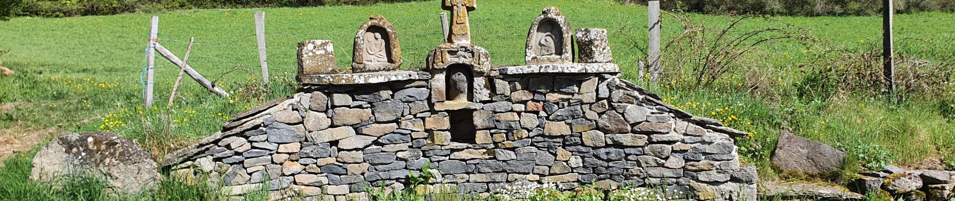
Courgoul_Plateau_Ussel

jagarnier
User GUIDE
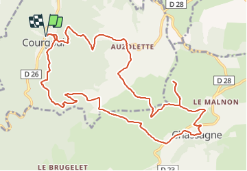

Length
13.6 km

Max alt
1038 m

Uphill gradient
591 m
Km-Effort
21 km

Min alt
596 m

Downhill gradient
591 m
Boucle
Yes
Creation date :
2022-04-19 06:36:22.097
Updated on :
2023-11-29 08:58:39.148
4h00
Difficulty : Difficult

FREE GPS app for hiking
 SityTrail
IGN / Geographical institutes
SityTrail Plus
The world is yours!
About
Trail Walking of 13.6 km to be discovered at Auvergne-Rhône-Alpes, Puy-de-Dôme, Courgoul. This trail is proposed by jagarnier.
Photos

Positioning
Country:
France
Region :
Auvergne-Rhône-Alpes
Department/Province :
Puy-de-Dôme
Municipality :
Courgoul
Location:
Unknown
Start:(Dec)
Start:(UTM)
503067 ; 5040141 (31T) N.
Comments