Trail Walking Saint-Appolinard - St APPOLINARD 17 720  - Photo
 6ARVAL7
6ARVAL7

User

© OpenStreetMap contributors
Length
Length
16.8 km
Max alt
Max alt
1085 m
Uphill gradient
Uphill gradient
714 m
Km-Effort
Km-Effort  
26 km
Min alt
Min alt
446 m
Downhill gradient
Downhill gradient
714 m
Boucle
Boucle
Yes
Creation date :
2022-04-18 07:23:46.861
Updated on :
2022-04-19 16:58:04.427

(0 Reviews)

Walking
Walking
6h01
Difficulty : Difficult

Scan this QR Code to open this trail in the SityTrail application

FREE GPS app for hiking

Logo SityTrail SityTrail

IGN / Geographical institutes

Download SityTrail from the App Store Download SityTrail from Google Play

Logo SityTrail SityTrail World

The world is yours!

Download SityTrail from the App Store Download SityTrail from Google Play Download SityTrail on Huawei AppGallery

About

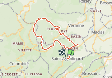
Trail Walking of 16.8 km to be discovered at Auvergne-Rhône-Alpes, Loire, Saint-Appolinard. This trail is proposed by 6ARVAL7.

Description

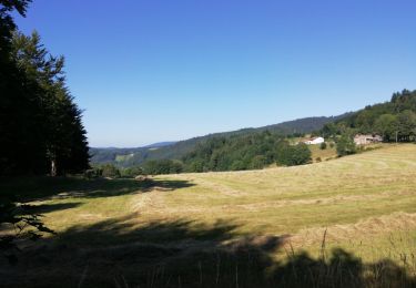
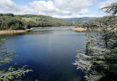
Très belle randonnée dans les paysages typiques du Pilât.  Attention ça monte au début pendant 630 m sans arrêt. On peu passer par la chapelle mais ça rajoute 70 D .

Elevation profile

Positioning

Country:
France
Region :
Auvergne-Rhône-Alpes
Department/Province :
Loire
Municipality :
Saint-Appolinard
Location:
Unknown
Start:(UTM)
629390 ; 5022190 (31T) N.

Trails nearby

Trail On foot Maclas - Maclas - 11,1 km - 227 m de dénivelé - 3h30 - Photo
On foot
Clubléorando

On foot

Medium
(1)
Maclas, Auvergne-Rhône-Alpes, Loire, France
11.1 km | 14.1 km-effort
3h 30min
Yes
Trail sport Brossainc - Brossainc lac du Ternay  - Photo
sport
alinetpierre

sport

Very easy
Brossainc, Auvergne-Rhône-Alpes, Ardèche, France
18 km | 25 km-effort
Unknown
Yes
Trail Walking Colombier - 42-st-sabin-pilat-18km-610m-juil21 - Photo
Walking
SyMA

Walking

Medium
Colombier, Auvergne-Rhône-Alpes, Loire, France
18.9 km | 27 km-effort
5h 19min
Yes
Trail Walking Colombier - 42-st-sabin-cret-de-perdrix-16km-620m - Photo
Walking
SyMA

Walking

Medium
Colombier, Auvergne-Rhône-Alpes, Loire, France
16 km | 24 km-effort
3h 57min
Yes
Trail Walking Savas - 07 Lac du ternay / croix des Blaches 8km 230M - Photo
Walking
SyMA

Walking

Very easy
(1)
Savas, Auvergne-Rhône-Alpes, Ardèche, France
8 km | 11 km-effort
2h 20min
Yes
Trail Walking Véranne - pilat-TDF-saint sabin - Photo
Walking
m261212

Walking

Medium
(1)
Véranne, Auvergne-Rhône-Alpes, Loire, France
17.9 km | 26 km-effort
5h 20min
Yes
Trail Mountain bike Bessey - Autour de Pélussin - Photo
Mountain bike
tracegps

Mountain bike

Difficult
Bessey, Auvergne-Rhône-Alpes, Loire, France
29 km | 38 km-effort
3h 0min
Yes
Trail Walking Saint-Appolinard - St Appolinard St Blandine - Photo
Walking
novop

Walking

Easy
Saint-Appolinard, Auvergne-Rhône-Alpes, Loire, France
6.7 km | 10.7 km-effort
1h 17min
Yes
Trail Walking Véranne - verannes - Photo
Walking
bpc

Walking

Medium
Véranne, Auvergne-Rhône-Alpes, Loire, France
8.6 km | 12.9 km-effort
2h 19min
Yes


Close
My subscriptions