


G2 - Sarrat Broucous en traversée

mitch1952
User

Length
11.5 km

Max alt
1339 m

Uphill gradient
817 m
Km-Effort
22 km

Min alt
565 m

Downhill gradient
720 m
Boucle
No
Creation date :
2022-04-19 14:26:33.118
Updated on :
2022-04-19 15:13:45.064
5h01
Difficulty : Very difficult

FREE GPS app for hiking
 SityTrail
IGN / Geographical institutes
SityTrail Plus
The world is yours!
About
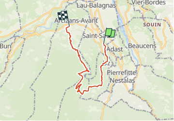
Trail Walking of 11.5 km to be discovered at Occitania, Hautespyrenees, Saint-Savin. This trail is proposed by mitch1952.
Description
Mouvement de véhicule
Positioning
Country:
France
Region :
Occitania
Department/Province :
Hautespyrenees
Municipality :
Saint-Savin
Location:
Unknown
Start:(Dec)
Start:(UTM)
737519 ; 4762290 (30T) N.
Comments