


Heidenkopf et Purpurkopf

Gaëtan Isb
User
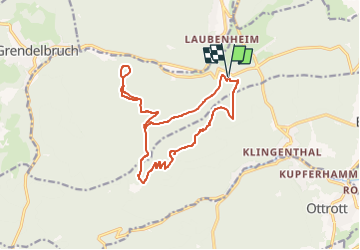

Length
16.1 km

Max alt
790 m

Uphill gradient
576 m
Km-Effort
24 km

Min alt
387 m

Downhill gradient
575 m
Boucle
Yes
Creation date :
2022-04-20 14:08:11.339
Updated on :
2022-04-20 14:12:30.734
5h24
Difficulty : Very difficult

FREE GPS app for hiking
 SityTrail
IGN / Geographical institutes
SityTrail Plus
The world is yours!
About
Trail Walking of 16.1 km to be discovered at Grand Est, Bas-Rhin, Rosheim. This trail is proposed by Gaëtan Isb.
Description
Test.
Positioning
Country:
France
Region :
Grand Est
Department/Province :
Bas-Rhin
Municipality :
Rosheim
Location:
Unknown
Start:(Dec)
Start:(UTM)
381008 ; 5371672 (32U) N.
Comments