


20220421 Caudebec en Caux

Childebert
User

Length
21 km

Max alt
142 m

Uphill gradient
516 m
Km-Effort
28 km

Min alt
5 m

Downhill gradient
516 m
Boucle
Yes
Creation date :
2022-04-21 07:33:02.969
Updated on :
2022-04-21 18:37:06.007
6h35
Difficulty : Medium

FREE GPS app for hiking
 SityTrail
IGN / Geographical institutes
SityTrail Plus
The world is yours!
About
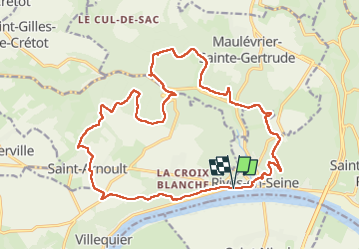
Trail Walking of 21 km to be discovered at Normandy, Seine-Maritime, Rives-en-Seine. This trail is proposed by Childebert.
Photos

Positioning
Country:
France
Region :
Normandy
Department/Province :
Seine-Maritime
Municipality :
Rives-en-Seine
Location:
Unknown
Start:(Dec)
Start:(UTM)
334804 ; 5488211 (31U) N.
Comments