


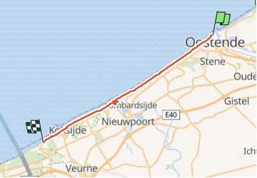
Ostende - La Panne

seghth
User

Length
30 km

Max alt
31 m

Uphill gradient
248 m
Km-Effort
33 km

Min alt
-3 m

Downhill gradient
249 m
Boucle
No
Creation date :
2022-04-23 11:35:59.815
Updated on :
2022-04-23 18:53:35.39
7h00
Difficulty : Very difficult

FREE GPS app for hiking
 SityTrail
IGN / Geographical institutes
SityTrail Plus
The world is yours!
About
Trail Walking of 30 km to be discovered at Flanders, West Flanders, Ostend. This trail is proposed by seghth.
Description
Beach walk
Positioning
Country:
Belgium
Region :
Flanders
Department/Province :
West Flanders
Municipality :
Ostend
Location:
Oostende
Start:(Dec)
Start:(UTM)
494106 ; 5675885 (31U) N.
Comments