Trail Walking Wambrechies - Des forts de Bondues au Canal de Roubaix - Photo

Des forts de Bondues au Canal de Roubaix

 Greg813
Greg813

User

© OpenStreetMap contributors
Length
Length
25 km
Max alt
Max alt
42 m
Uphill gradient
Uphill gradient
149 m
Km-Effort
Km-Effort  
27 km
Min alt
Min alt
12 m
Downhill gradient
Downhill gradient
148 m
Boucle
Boucle
Yes
Creation date :
2022-04-24 07:52:54.533
Updated on :
2022-06-08 16:30:26.818

(0 Reviews)

Walking
Walking
5h01
Difficulty : Easy

Scan this QR Code to open this trail in the SityTrail application

FREE GPS app for hiking

Logo SityTrail SityTrail

IGN / Geographical institutes

Download SityTrail from the App Store Download SityTrail from Google Play

Logo SityTrail SityTrail World

The world is yours!

Download SityTrail from the App Store Download SityTrail from Google Play Download SityTrail on Huawei AppGallery

About

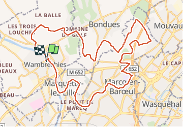
Trail Walking of 25 km to be discovered at Hauts-de-France, Nord, Wambrechies. This trail is proposed by Greg813.

Description

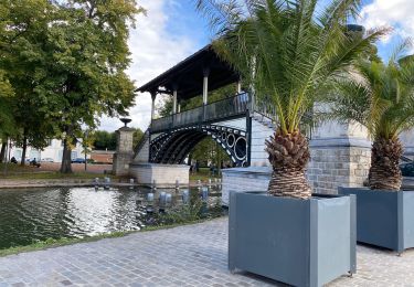
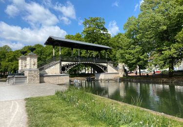
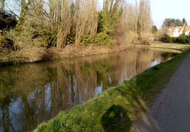
Randonnée semi-urbaine avec Mettons le Monde en Marche entre Bondues et Marcq en Baroeul.

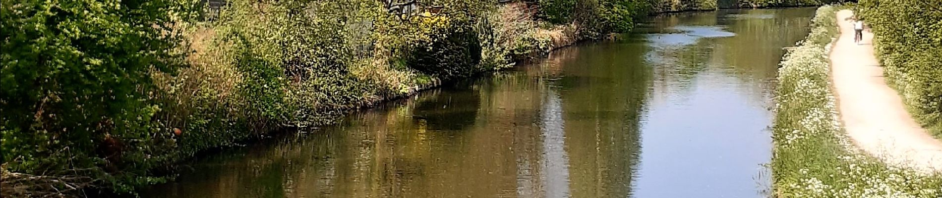
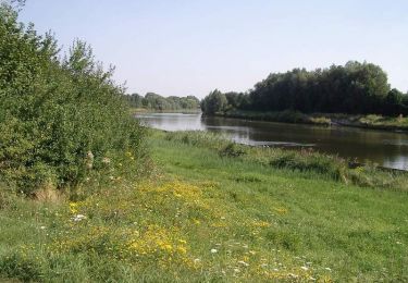
Beaucoup de verdure et le cheminement le long du canal de Roubaix est très agréable.

Pour d'autres photos, voir le site de l'association :
https://mmm-rando.org/randonnee-semi-urbaine-2022/

Elevation profile

Photos

Positioning

Country:
France
Region :
Hauts-de-France
Department/Province :
Nord
Municipality :
Wambrechies
Location:
Unknown
Start:(UTM)
503772 ; 5615115 (31U) N.

Trails nearby

Trail Cycle Wambrechies - La Deule canalisée - Wambrechies - Photo
Cycle
tracegps

Cycle

Medium
(2)
Wambrechies, Hauts-de-France, Nord, France
40 km | 43 km-effort
2h 30min
Yes
Trail Walking Quesnoy-sur-Deûle - Circuit du grand Perne - Quesnoy-sur-Deule - Photo
Walking
tracegps

Walking

Medium
(2)
Quesnoy-sur-Deûle, Hauts-de-France, Nord, France
10.6 km | 11.1 km-effort
2h 40min
Yes
Trail Walking Wambrechies - Circuit du Genièvre - Wambrechies - Photo
Walking
tracegps

Walking

Medium
(2)
Wambrechies, Hauts-de-France, Nord, France
13.3 km | 14.2 km-effort
3h 15min
Yes
Trail Mountain bike Lambersart - Deûle et ses campagnes - Photo
Mountain bike
nicowear

Mountain bike

Easy
(2)
Lambersart, Hauts-de-France, Nord, France
24 km | 25 km-effort
1h 25min
Yes
Trail Walking Wambrechies - wambrechies quesnois - Photo
Walking
Bernard.voyageur

Walking

Easy
(1)
Wambrechies, Hauts-de-France, Nord, France
10.7 km | 11.4 km-effort
2h 31min
Yes
Trail Walking Lille - Lille 9,5 km - Photo
Walking
GUIDE
rvapeldo

Walking

Easy
Lille, Hauts-de-France, Nord, France
10.3 km | 11.3 km-effort
4h 24min
Yes
Trail Walking Lille - Lille Citadelle parcs remparts centre 12,5  km - Photo
Walking
GUIDE
rvapeldo

Walking

Easy
Lille, Hauts-de-France, Nord, France
13.2 km | 14.5 km-effort
4h 53min
Yes
Trail Walking Bondues - Bondue 18/02/17 - Photo
Walking
roclem421

Walking

Easy
Bondues, Hauts-de-France, Nord, France
12.2 km | 13.1 km-effort
2h 53min
Yes
Trail Walking Verlinghem - Le chemin des Templiers - Verlinghem - Photo
Walking
tracegps

Walking

Easy
(1)
Verlinghem, Hauts-de-France, Nord, France
5.8 km | 6.3 km-effort
1h 30min
Yes


Close
My subscriptions