


Besse_Pavin_Chiloza

jagarnier
User GUIDE
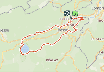


5h30
Difficulty : Medium

FREE GPS app for hiking
 SityTrail
IGN / Geographical institutes
SityTrail Plus
The world is yours!
About
Trail Walking of 18.2 km to be discovered at Auvergne-Rhône-Alpes, Puy-de-Dôme, Besse-et-Saint-Anastaise. This trail is proposed by jagarnier.
Description
Le Puy de Montchal à 1407 m d’altitude est le volcan le plus jeune de France : à peine 7000 ans !
Il a fait apparaître, à ses pieds, le Lac Pavin. Ce lac, entouré d’une belle forêt de hêtres et de conifères, a un diamètre de 750 m et mesure plus de 90 m de profondeur.
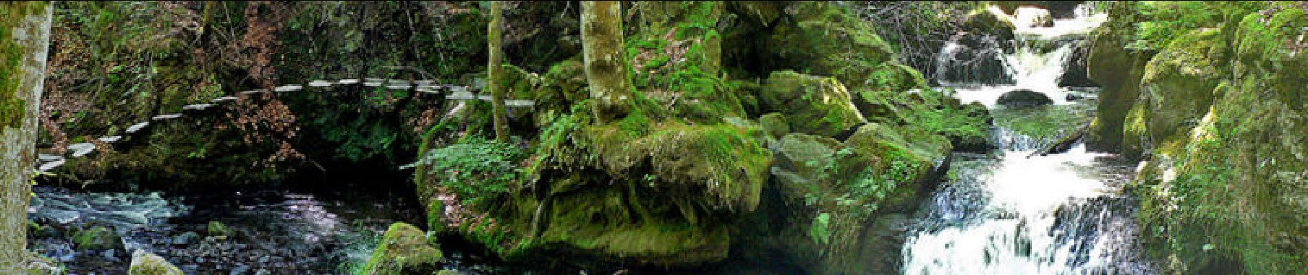
Les cascades de Chiloza se succèdent sur la couze Pavin, torrent venant du Lac Pavin. Les ‘oules’ ou ‘marmites de géants’ creusées dans la lave jalonnent le lit de la rivière.
C’est dans un paysage typique des monts d’Auvergne que se déroule cette balade. Conifères sur les pentes exposées au(…)
Photos

Positioning
Comments