Trail On foot Saint-Benoît - CFR - 25000 -carte #18 - Photo

CFR - 25000 -carte #18

© OpenStreetMap contributors
Length
Length
126 km
Max alt
Max alt
216 m
Uphill gradient
Uphill gradient
2001 m
Km-Effort
Km-Effort  
153 km
Min alt
Min alt
-9 m
Downhill gradient
Downhill gradient
2001 m
Boucle
Boucle
No
Creation date :
2022-04-28 05:00:30.662
Updated on :
2022-05-11 05:07:41.063

(0 Reviews)

On foot
On foot
34h47
Difficulty : Very difficult

Scan this QR Code to open this trail in the SityTrail application

FREE GPS app for hiking

Logo SityTrail SityTrail

IGN / Geographical institutes

Download SityTrail from the App Store Download SityTrail from Google Play

Logo SityTrail SityTrail World

The world is yours!

Download SityTrail from the App Store Download SityTrail from Google Play Download SityTrail on Huawei AppGallery

About

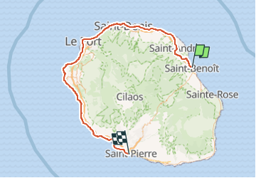
Trail On foot of 126 km to be discovered at Réunion, Unknown, Saint-Benoît. This trail is proposed by meyrignac.

Description

Tracé de l'ancienne ligne de chemin de fer de la Réunion
Pour plus de détails voir
http://trainlontan.re

Elevation profile

Positioning

Country:
France
Region :
Réunion
Department/Province :
Unknown
Municipality :
Saint-Benoît
Location:
Unknown
Start:(UTM)
366534 ; 7673874 (40K) S.

Trails nearby

Trail Walking Saint-Benoît - BASSINS LA MER ET LA PAIX - Photo
Walking
HILLEBRAND

Walking

Very easy
(1)
Saint-Benoît, Réunion, Unknown, France
4.7 km | 6.2 km-effort
2h 0min
Yes
Trail Walking Saint-Benoît - Bassins la paix et la met - Photo
Walking
Morelli

Walking

Easy
Saint-Benoît, Réunion, Unknown, France
4.8 km | 6.6 km-effort
2h 33min
Yes


Close
My subscriptions