


CHATEAU ARNOUX . Chapelle S Jean o l

RobinMicheline
User GUIDE
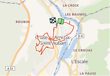

Length
9 km

Max alt
646 m

Uphill gradient
244 m
Km-Effort
12.3 km

Min alt
429 m

Downhill gradient
244 m
Boucle
Yes
Creation date :
2022-04-28 12:26:06.365
Updated on :
2022-04-29 17:28:22.671
2h35
Difficulty : Easy

FREE GPS app for hiking
 SityTrail
IGN / Geographical institutes
SityTrail Plus
The world is yours!
About
Trail Walking of 9 km to be discovered at Provence-Alpes-Côte d'Azur, Alpes-de-Haute-Provence, Château-Arnoux-Saint-Auban. This trail is proposed by RobinMicheline.
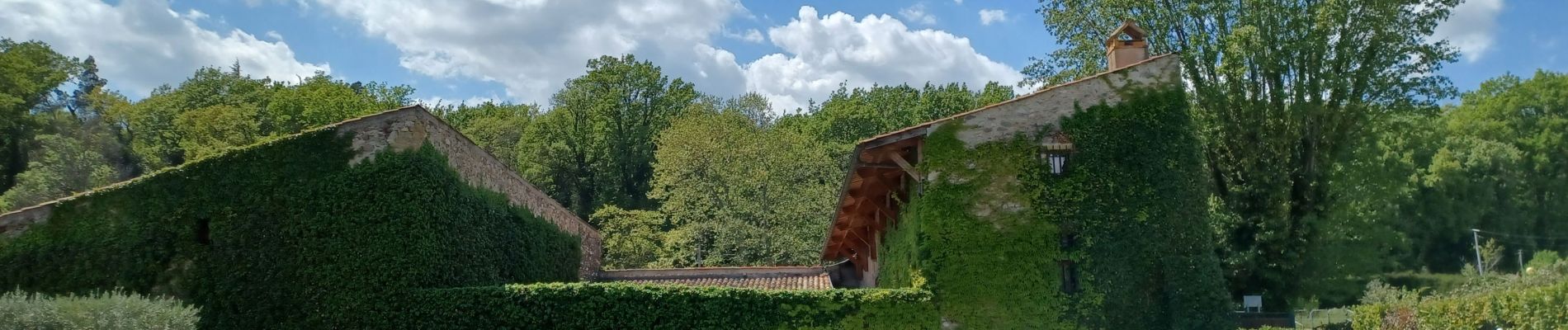
Photos


22 photos in total. Please click on a photo to see them all in the gallery.
Positioning
Country:
France
Region :
Provence-Alpes-Côte d'Azur
Department/Province :
Alpes-de-Haute-Provence
Municipality :
Château-Arnoux-Saint-Auban
Location:
Unknown
Start:(Dec)
Start:(UTM)
260679 ; 4887168 (32T) N.
Comments