


N° 201 - 2020 08 16 - Boucle Pedernec

Jean-marc77
User

Length
24 km

Max alt
202 m

Uphill gradient
243 m
Km-Effort
27 km

Min alt
108 m

Downhill gradient
244 m
Boucle
Yes
Creation date :
2022-04-29 07:47:17.08
Updated on :
2022-04-29 07:47:17.08
1h51
Difficulty : Medium

FREE GPS app for hiking
 SityTrail
IGN / Geographical institutes
SityTrail Plus
The world is yours!
About
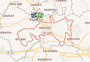
Trail Mountain bike of 24 km to be discovered at Brittany, Côtes-d'Armor, Pédernec. This trail is proposed by Jean-marc77.
Positioning
Country:
France
Region :
Brittany
Department/Province :
Côtes-d'Armor
Municipality :
Pédernec
Location:
Unknown
Start:(Dec)
Start:(UTM)
480098 ; 5382610 (30U) N.
Comments