


avec val

malc
User
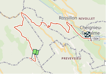

Length
8.9 km

Max alt
1155 m

Uphill gradient
43 m
Km-Effort
12.2 km

Min alt
327 m

Downhill gradient
850 m
Boucle
No
Creation date :
2022-04-30 12:32:30.074
Updated on :
2022-06-04 17:38:12.433
45m
Difficulty : Easy

FREE GPS app for hiking
 SityTrail
IGN / Geographical institutes
SityTrail Plus
The world is yours!
About
Trail Mountain bike of 8.9 km to be discovered at Auvergne-Rhône-Alpes, Ain, Ordonnaz. This trail is proposed by malc.
Positioning
Country:
France
Region :
Auvergne-Rhône-Alpes
Department/Province :
Ain
Municipality :
Ordonnaz
Location:
Unknown
Start:(Dec)
Start:(UTM)
699855 ; 5076714 (31T) N.
Comments