


Roussenac

Levillefranchois
User
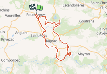

Length
37 km

Max alt
604 m

Uphill gradient
795 m
Km-Effort
47 km

Min alt
400 m

Downhill gradient
796 m
Boucle
No
Creation date :
2022-04-30 11:44:47.0
Updated on :
2022-04-30 15:01:34.201
3h15
Difficulty : Medium

FREE GPS app for hiking
 SityTrail
IGN / Geographical institutes
SityTrail Plus
The world is yours!
About
Trail Mountain bike of 37 km to be discovered at Occitania, Aveyron, Roussennac. This trail is proposed by Levillefranchois.
Description
Roussenac
Positioning
Country:
France
Region :
Occitania
Department/Province :
Aveyron
Municipality :
Roussennac
Location:
Unknown
Start:(Dec)
Start:(UTM)
440556 ; 4922532 (31T) N.
Comments