


L' ancien canal St Charles, sentier de l'Arc, le haras, la voie verte

ericberlin
User

Length
16.7 km

Max alt
295 m

Uphill gradient
206 m
Km-Effort
19.5 km

Min alt
190 m

Downhill gradient
208 m
Boucle
Yes
Creation date :
2022-04-30 16:42:34.422
Updated on :
2022-11-04 17:57:45.856
4h25
Difficulty : Very difficult
1h21
Difficulty : Easy

FREE GPS app for hiking
 SityTrail
IGN / Geographical institutes
SityTrail Plus
The world is yours!
About
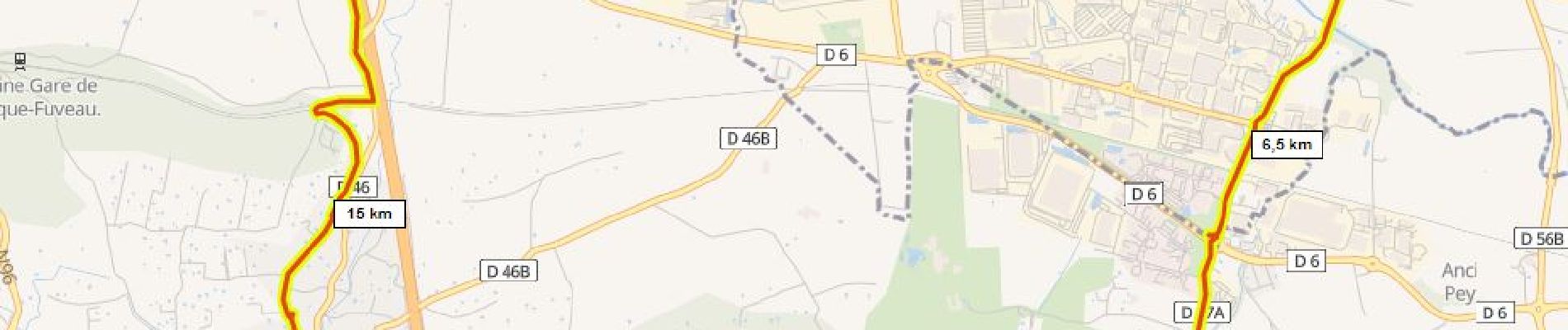
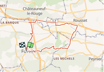
Trail Walking of 16.7 km to be discovered at Provence-Alpes-Côte d'Azur, Bouches-du-Rhône, Fuveau. This trail is proposed by ericberlin.
Photos

Positioning
Country:
France
Region :
Provence-Alpes-Côte d'Azur
Department/Province :
Bouches-du-Rhône
Municipality :
Fuveau
Location:
Unknown
Start:(Dec)
Start:(UTM)
706986 ; 4814364 (31T) N.
Comments