


Urbain V 2

bymarc26
User
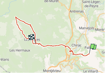

Length
30 km

Max alt
1397 m

Uphill gradient
918 m
Km-Effort
41 km

Min alt
603 m

Downhill gradient
636 m
Boucle
No
Creation date :
2022-05-02 07:46:58.745
Updated on :
2022-05-02 14:42:14.607
5h15
Difficulty : Medium

FREE GPS app for hiking
 SityTrail
IGN / Geographical institutes
SityTrail Plus
The world is yours!
About
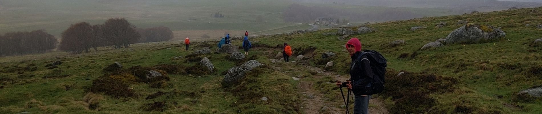
Trail Walking of 30 km to be discovered at Occitania, Lozère, Palhers. This trail is proposed by bymarc26.
Description
fait à l'envers pour échange de véhicule avec un autre groupe
Photos


Positioning
Country:
France
Region :
Occitania
Department/Province :
Lozère
Municipality :
Palhers
Location:
Unknown
Start:(Dec)
Start:(UTM)
523560 ; 4928599 (31T) N.
Comments