Trail Walking Doische - Promenade de la Bonne-Fontaine   - Photo

Promenade de la Bonne-Fontaine

« L’heure de la fin des découvertes ne sonne jamais. » Colette GUIDE+

© OpenStreetMap contributors
Length
Length
7.3 km
Max alt
Max alt
221 m
Uphill gradient
Uphill gradient
155 m
Km-Effort
Km-Effort  
9.4 km
Min alt
Min alt
138 m
Downhill gradient
Downhill gradient
154 m
Boucle
Boucle
Yes
Creation date :
2022-05-04 13:08:49.056
Updated on :
2022-05-04 20:19:14.833

(3 Reviews)

Walking
Walking
2h07
Difficulty : Medium

Scan this QR Code to open this trail in the SityTrail application

FREE GPS app for hiking

Logo SityTrail SityTrail

IGN / Geographical institutes

Download SityTrail from the App Store Download SityTrail from Google Play

Logo SityTrail SityTrail World

The world is yours!

Download SityTrail from the App Store Download SityTrail from Google Play Download SityTrail on Huawei AppGallery

About

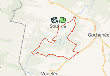
Trail Walking of 7.3 km to be discovered at Wallonia, Namur, Doische. This trail is proposed by Au fil de nos découvertes.

Description

🌳❤️
🅿️ Départ et Parking:
Rue Sainte-Colombes,
5680 Doische, Belgique
Coordonnées GPS : 9F265PPP RW
▶️ Suivre la balise "rectangle rouge"
🥾 Prévoir de bonnes chaussures de marche.
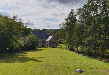
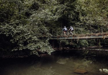
Cette promenade vous emmène au cœur du village de Soulme, un des Plus Beaux Village de Wallonie, situé au sommet d'une colline dominant la vallée de l'Hermeton. 🌳
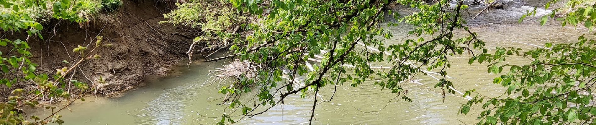
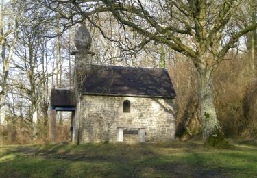
Par chemins et sentiers , vous découvrirez les bords de l'Hermeton jusqu'à la chapelle de Bonne Fontaine et à proximité du moulin de Soulme. 💦
Cette promenade vous offre également de magnifiques points de vue. 😍
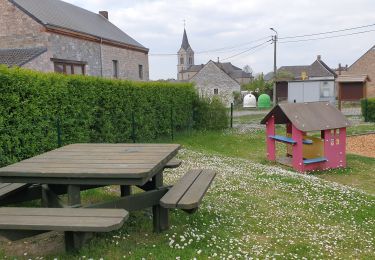
Possibilités de pique-niquer. 🥪🍴
Chiens autorisés en laisse. 🐩🐶🐕
Convient pour les enfants . 👱👱‍♂️  
Ne convient pas pour les poussettes et personnes à mobilité réduite. 👨‍🦽👩‍🦽👶
N'hésitez pas à aller faire un tour sur notre site internet et nos réseaux :
www.aufildenosdecouvertes.com
www.facebook.com/aufildenosdecouvertes
https://www.instagram.com/au_fil_de_nos_decouvertes

Elevation profile

Photos

Positioning

Country:
Belgium
Region :
Wallonia
Department/Province :
Namur
Municipality :
Doische
Location:
Unknown
Start:(UTM)
624011 ; 5560870 (31U) N.

Comments

Please log in to post a review or rate the element


Trails nearby

Trail Walking Doische - RB-Na-11 La vallée de l’Hermeton - Photo
Walking
PRO

Walking

Medium
(4)
Doische, Wallonia, Namur, Belgium
25 km | 31 km-effort
6h 40min
Yes
Trail Walking Doische - RB-Na-11 Raccourci - La vallée de l’Hermeton - Photo
Walking
PRO

Walking

Medium
(4)
Doische, Wallonia, Namur, Belgium
19.7 km | 25 km-effort
5h 22min
Yes
Trail Walking Doische - De Gochenee vers Soulme par la vallee de l'Ermeton - Photo
Walking
GUIDE
Desrumaux

Walking

Medium
(1)
Doische, Wallonia, Namur, Belgium
18.5 km | 24 km-effort
4h 40min
Yes
Trail Walking Doische - Promenade à Vodelée - Photo
Walking
GUIDE
Desrumaux

Walking

Easy
(1)
Doische, Wallonia, Namur, Belgium
9.3 km | 11.4 km-effort
2h 15min
Yes
Trail Walking Florennes - De Morville à Miavoye par le bois et le château de Fontaine - Photo
Walking
GUIDE
Desrumaux

Walking

Very easy
(3)
Florennes, Wallonia, Namur, Belgium
7.5 km | 9.2 km-effort
2h 0min
Yes
Trail Walking Doische - La Boucle de l'Hermeton - Photo
Walking
GUIDE
Desrumaux

Walking

Difficult
Doische, Wallonia, Namur, Belgium
19 km | 24 km-effort
2h 50min
Yes
Trail Walking Doische - De Gochenée à Vodelée par la vallée de l'Hermeton - Photo
Walking
GUIDE
Desrumaux

Walking

Difficult
Doische, Wallonia, Namur, Belgium
10.7 km | 12.9 km-effort
3h 46min
Yes
Trail Mountain bike Philippeville - Boucle de l'Hermeton - Photo
Mountain bike
GUIDE+

Mountain bike

Medium
Philippeville, Wallonia, Namur, Belgium
21 km | 25 km-effort
1h 46min
Yes
Trail On foot Doische - Bonne Fontaine - Photo
On foot
GUIDE+

On foot

Easy
(1)
Doische, Wallonia, Namur, Belgium
7.4 km | 9.5 km-effort
2h 9min
Yes


Close
My subscriptions