


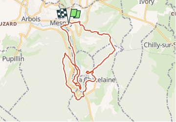
depart parking cimetiere de mesnay vers la chatelaine

gerardmicheline
User

Length
19 km

Max alt
584 m

Uphill gradient
558 m
Km-Effort
26 km

Min alt
303 m

Downhill gradient
559 m
Boucle
Yes
Creation date :
2022-05-04 15:37:55.899
Updated on :
2022-05-04 15:39:12.78
6h00
Difficulty : Very difficult

FREE GPS app for hiking
 SityTrail
IGN / Geographical institutes
SityTrail Plus
The world is yours!
About
Trail Walking of 19 km to be discovered at Bourgogne-Franche-Comté, Jura, Mesnay. This trail is proposed by gerardmicheline.
Positioning
Country:
France
Region :
Bourgogne-Franche-Comté
Department/Province :
Jura
Municipality :
Mesnay
Location:
Unknown
Start:(Dec)
Start:(UTM)
713215 ; 5197913 (31T) N.
Comments