Trail Walking Shalë - étape 1 : Theth (Al)	Valbone (Al) - Photo

étape 1 : Theth (Al) Valbone (Al)

 heb
heb

User

© OpenStreetMap contributors
Length
Length
13.6 km
Max alt
Max alt
1831 m
Uphill gradient
Uphill gradient
1118 m
Km-Effort
Km-Effort  
28 km
Min alt
Min alt
744 m
Downhill gradient
Downhill gradient
866 m
Boucle
Boucle
No
Creation date :
2014-12-10 00:00:00.0
Updated on :
2014-12-10 00:00:00.0

(0 Reviews)

Walking
Walking
5h38
Difficulty : Medium

Scan this QR Code to open this trail in the SityTrail application

FREE GPS app for hiking

Logo SityTrail SityTrail

IGN / Geographical institutes

Download SityTrail from the App Store Download SityTrail from Google Play

Logo SityTrail SityTrail World

The world is yours!

Download SityTrail from the App Store Download SityTrail from Google Play Download SityTrail on Huawei AppGallery

About

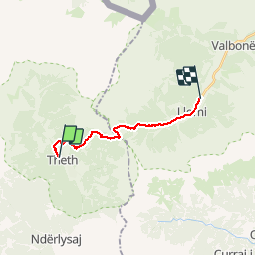
Trail Walking of 13.6 km to be discovered at Northern Albania, Shkodër County, Shalë. This trail is proposed by heb.

Description

distance=13.90 km dénivelé=1,068 m alt=1,759 m
durée=7 hrs

Elevation profile

Points of interest

Point of interest Margegaj - Rilindja hôtel - Photo
heb
MARGEGAJ 

Positioning

Country:
Albania
Region :
Northern Albania
Department/Province :
Shkodër County
Municipality :
Shalë
Location:
Unknown
Start:(UTM)
399038 ; 4694459 (34T) N.

Trails nearby

Trail Walking Shalë - POB 3 - Theth to Cerem - Photo
Walking
Nicolas Van Meerbeck

Walking

Difficult
Shalë, Northern Albania, Shkodër County, Albania
30 km | 52 km-effort
9h 4min
No


Close
My subscriptions