


G3SoulorSurgatteretouché

LouisROGER
User GUIDE
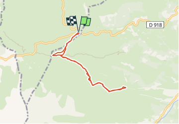

Length
7.3 km

Max alt
1795 m

Uphill gradient
393 m
Km-Effort
12.5 km

Min alt
1468 m

Downhill gradient
393 m
Boucle
Yes
Creation date :
2022-05-06 07:38:55.466
Updated on :
2022-05-06 19:57:27.854
2h16
Difficulty : Difficult

FREE GPS app for hiking
 SityTrail
IGN / Geographical institutes
SityTrail Plus
The world is yours!
About
Trail Walking of 7.3 km to be discovered at Occitania, Hautespyrenees, Arbéost. This trail is proposed by LouisROGER.
Positioning
Country:
France
Region :
Occitania
Department/Province :
Hautespyrenees
Municipality :
Arbéost
Location:
Unknown
Start:(Dec)
Start:(UTM)
723362 ; 4760110 (30T) N.
Comments