


pointe st laurent

Morin thierry
User
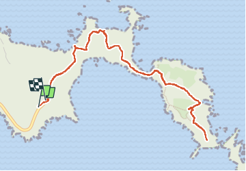

Length
7.9 km

Max alt
136 m

Uphill gradient
445 m
Km-Effort
13.8 km

Min alt
0 m

Downhill gradient
445 m
Boucle
Yes
Creation date :
2022-05-06 12:24:15.445
Updated on :
2022-05-06 15:48:33.364
3h15
Difficulty : Easy

FREE GPS app for hiking
 SityTrail
IGN / Geographical institutes
SityTrail Plus
The world is yours!
About
Trail Walking of 7.9 km to be discovered at Madeira, Unknown, Caniçal. This trail is proposed by Morin thierry .
Description
rando
Positioning
Country:
Portugal
Region :
Madeira
Department/Province :
Unknown
Municipality :
Caniçal
Location:
Unknown
Start:(Dec)
Start:(UTM)
340516 ; 3624026 (28S) N.
Comments