Trail Walking Auteuil - Autouillet - Photo
 mallovon
mallovon

User

© OpenStreetMap contributors
Length
Length
5.5 km
Max alt
Max alt
157 m
Uphill gradient
Uphill gradient
45 m
Km-Effort
Km-Effort  
6.2 km
Min alt
Min alt
93 m
Downhill gradient
Downhill gradient
73 m
Boucle
Boucle
No
Creation date :
2022-05-07 09:58:04.582
Updated on :
2022-05-07 12:12:24.045

(0 Reviews)

Walking
Walking
1h33
Difficulty : Easy

Scan this QR Code to open this trail in the SityTrail application

FREE GPS app for hiking

Logo SityTrail SityTrail

IGN / Geographical institutes

Download SityTrail from the App Store Download SityTrail from Google Play

Logo SityTrail SityTrail World

The world is yours!

Download SityTrail from the App Store Download SityTrail from Google Play Download SityTrail on Huawei AppGallery

About

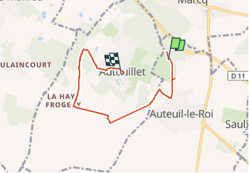
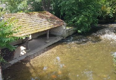
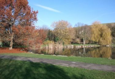
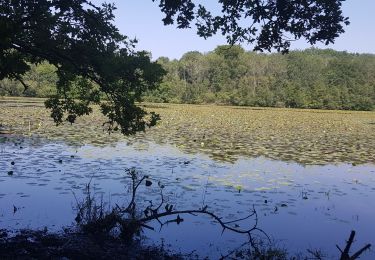
Trail Walking of 5.5 km to be discovered at Ile-de-France, Yvelines, Auteuil. This trail is proposed by mallovon.

Description

Balade 18. Variante aqueduc.

Elevation profile

Photos

Positioning

Country:
France
Region :
Ile-de-France
Department/Province :
Yvelines
Municipality :
Auteuil
Location:
Unknown
Start:(UTM)
413021 ; 5411428 (31U) N.

Trails nearby

Trail Walking Auteuil - Auteuil Villiers le Mahieu - Photo
Walking
raivavae

Walking

Very easy
(1)
Auteuil, Ile-de-France, Yvelines, France
11.9 km | 13.2 km-effort
5min
Yes
Trail Walking Villiers-le-Mahieu - Villiers le Mahieu - Photo
Walking
mallovon

Walking

Medium
Villiers-le-Mahieu, Ile-de-France, Yvelines, France
10.3 km | 11.3 km-effort
3h 0min
Yes
Trail Plane Neauphle-le-Vieux - Chavenay Etretat  - Photo
Plane
mallovon

Plane

Very easy
Neauphle-le-Vieux, Ile-de-France, Yvelines, France
359 km | 441 km-effort
2h 3min
No
Trail Walking Thoiry - ADAL_Thoiry_28112017 - Photo
Walking
VVerley

Walking

Medium
(1)
Thoiry, Ile-de-France, Yvelines, France
18 km | 21 km-effort
4h 36min
Yes
Trail Walking Beynes - Sortie du 08/06/2017 - Photo
Walking
microb

Walking

Medium
Beynes, Ile-de-France, Yvelines, France
12.5 km | 15.2 km-effort
3h 30min
Yes
Trail Walking Beynes - Sur les traces de Marie de Cressay - Beynes - Photo
Walking
tracegps

Walking

Medium
(2)
Beynes, Ile-de-France, Yvelines, France
13.7 km | 16.7 km-effort
3h 30min
Yes
Trail Walking Beynes - Le Vignoble de Beynes - Beynes - Photo
Walking
tracegps

Walking

Medium
Beynes, Ile-de-France, Yvelines, France
10.7 km | 13 km-effort
3h 0min
Yes
Trail Walking Mareil-sur-Mauldre - De Chavoye au bois des Arpents - Mareil sur Mauldre - Photo
Walking
tracegps

Walking

Medium
Mareil-sur-Mauldre, Ile-de-France, Yvelines, France
11.2 km | 13.5 km-effort
3h 0min
Yes
Trail Walking Garancières - tacoigniere  - Photo
Walking
mimey

Walking

Very difficult
Garancières, Ile-de-France, Yvelines, France
36 km | 41 km-effort
6h 49min
Yes


Close
My subscriptions