


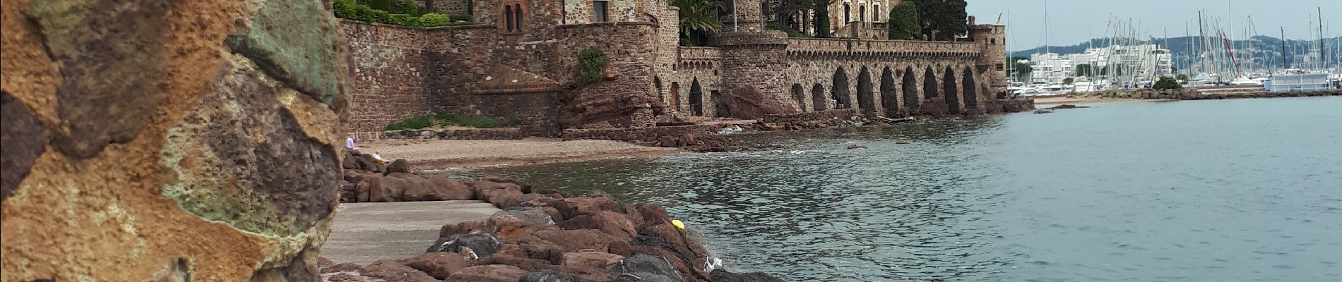
Balade Château Napoule

GrouGary
User
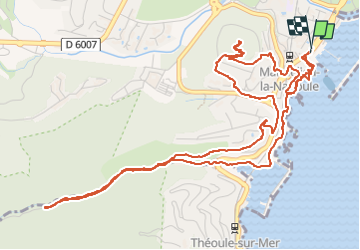

Length
8 km

Max alt
117 m

Uphill gradient
204 m
Km-Effort
10.7 km

Min alt
0 m

Downhill gradient
205 m
Boucle
Yes
Creation date :
2022-05-08 07:23:00.587
Updated on :
2022-05-08 13:47:45.833
2h16
Difficulty : Very easy

FREE GPS app for hiking
 SityTrail
IGN / Geographical institutes
SityTrail Plus
The world is yours!
About
Trail Walking of 8 km to be discovered at Provence-Alpes-Côte d'Azur, Maritime Alps, Mandelieu-la-Napoule. This trail is proposed by GrouGary.
Description
petite balade "decouverte"
Photos

Positioning
Country:
France
Region :
Provence-Alpes-Côte d'Azur
Department/Province :
Maritime Alps
Municipality :
Mandelieu-la-Napoule
Location:
Unknown
Start:(Dec)
Start:(UTM)
333795 ; 4821112 (32T) N.
Comments