


Gèdre lac de Bassia

chasle
User
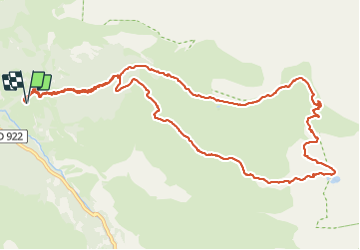

Length
14.7 km

Max alt
2284 m

Uphill gradient
1111 m
Km-Effort
30 km

Min alt
1183 m

Downhill gradient
1110 m
Boucle
Yes
Creation date :
2022-05-08 05:01:49.506
Updated on :
2023-08-17 17:10:44.008
5h20
Difficulty : Difficult

FREE GPS app for hiking
 SityTrail
IGN / Geographical institutes
SityTrail Plus
The world is yours!
About
Trail Walking of 14.7 km to be discovered at Occitania, Hautespyrenees, Gavarnie-Gèdre. This trail is proposed by chasle.
Positioning
Country:
France
Region :
Occitania
Department/Province :
Hautespyrenees
Municipality :
Gavarnie-Gèdre
Location:
Gèdre
Start:(Dec)
Start:(UTM)
257433 ; 4741096 (31T) N.
Comments