Trail Walking Risoul - plan de phazy par la forêt de risoul en boucle - Photo

plan de phazy par la forêt de risoul en boucle

 tchoua
tchoua

User

© OpenStreetMap contributors
Length
Length
17.5 km
Max alt
Max alt
2002 m
Uphill gradient
Uphill gradient
1234 m
Km-Effort
Km-Effort  
34 km
Min alt
Min alt
879 m
Downhill gradient
Downhill gradient
1240 m
Boucle
Boucle
Yes
Creation date :
2022-05-08 08:07:00.701
Updated on :
2022-05-08 13:34:18.943

(0 Reviews)

Walking
Walking
4h38
Difficulty : Difficult

Scan this QR Code to open this trail in the SityTrail application

FREE GPS app for hiking

Logo SityTrail SityTrail

IGN / Geographical institutes

Download SityTrail from the App Store Download SityTrail from Google Play

Logo SityTrail SityTrail World

The world is yours!

Download SityTrail from the App Store Download SityTrail from Google Play Download SityTrail on Huawei AppGallery

About

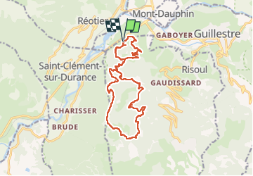
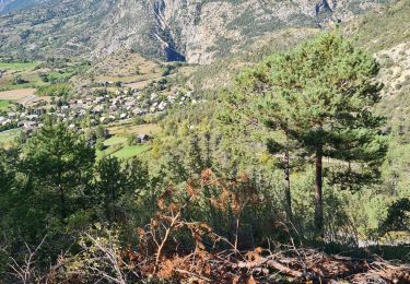
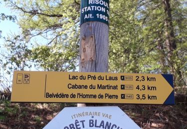
Trail Walking of 17.5 km to be discovered at Provence-Alpes-Côte d'Azur, Hautes-Alpes, Risoul. This trail is proposed by tchoua.

Description

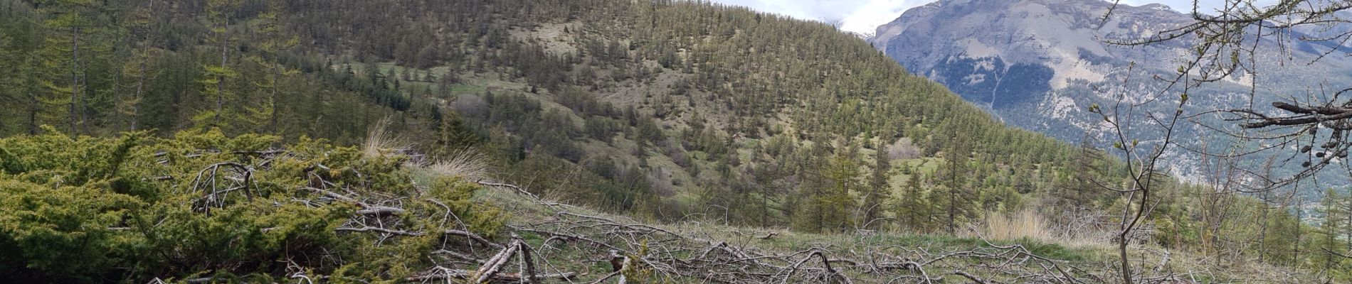
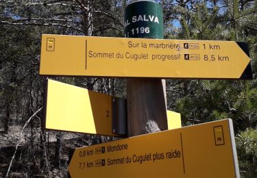
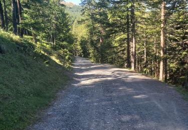
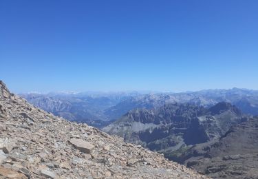
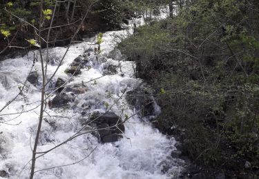
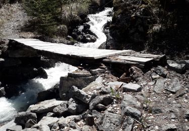
montée raide pour atteindre la crête, ensuite descente flechee à certains endroits mais pas de partout être attentif avoir GPS et carte c est mieux car avant de rejoindre le sentier de montée c est de la course d orientation la végétation à repoussé  sinon forêt de mélèzes magnifique

Elevation profile

Photos

Positioning

Country:
France
Region :
Provence-Alpes-Côte d'Azur
Department/Province :
Hautes-Alpes
Municipality :
Risoul
Location:
Unknown
Start:(UTM)
310036 ; 4947831 (32T) N.

Trails nearby

Trail Walking Guillestre - Rue des Masques - Photo
Walking
Dervalmarc

Walking

Very easy
(1)
Guillestre, Provence-Alpes-Côte d'Azur, Hautes-Alpes, France
5.1 km | 7.9 km-effort
1h 47min
Yes
Trail Walking Guillestre - guillestre, rif bel,col de la scie, crete de vars,la coulette et retour par riou bel - Photo
Walking
tchoua

Walking

Very difficult
Guillestre, Provence-Alpes-Côte d'Azur, Hautes-Alpes, France
24 km | 45 km-effort
6h 24min
Yes
Trail Walking Guillestre - cugulet aller retour  - Photo
Walking
tchoua

Walking

Medium
Guillestre, Provence-Alpes-Côte d'Azur, Hautes-Alpes, France
14.6 km | 33 km-effort
4h 2min
Yes
Trail Walking Guillestre - Roche Rousse et Rocher de l'aigle  à  Guillestre  - Photo
Walking
Sorriaux

Walking

Medium
Guillestre, Provence-Alpes-Côte d'Azur, Hautes-Alpes, France
8.6 km | 14 km-effort
2h 52min
Yes
Trail Walking Risoul - Crêtes de Penon - Photo
Walking
gildascb

Walking

Very easy
(1)
Risoul, Provence-Alpes-Côte d'Azur, Hautes-Alpes, France
10.6 km | 15.3 km-effort
3h 15min
Yes
Trail Walking Réotier - Tête de Vautisse  - Photo
Walking
Forain

Walking

Difficult
Réotier, Provence-Alpes-Côte d'Azur, Hautes-Alpes, France
12 km | 23 km-effort
8h 19min
Yes
Trail Walking Risoul - Risoul 1850  Le Villaret - Photo
Walking
Sorriaux

Walking

Medium
Risoul, Provence-Alpes-Côte d'Azur, Hautes-Alpes, France
12.3 km | 18.1 km-effort
4h 0min
No
Trail Walking Risoul - Le Villaret  plan Phazy - Photo
Walking
Sorriaux

Walking

Medium
Risoul, Provence-Alpes-Côte d'Azur, Hautes-Alpes, France
10.9 km | 16.5 km-effort
3h 11min
Yes
Trail Walking Guillestre - Le Villaret Barbein - Photo
Walking
Sorriaux

Walking

Medium
Guillestre, Provence-Alpes-Côte d'Azur, Hautes-Alpes, France
10.2 km | 16.2 km-effort
3h 7min
Yes


Close
My subscriptions