


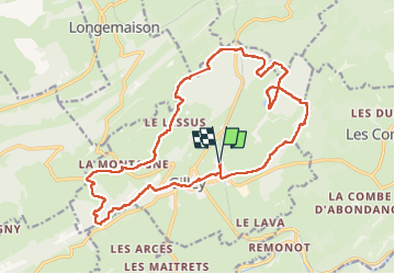

15.1 km | 20 km-effort


User


FREE GPS app for hiking
 SityTrail
IGN / Geographical institutes
SityTrail World
The world is yours!
Trail Walking of 21 km to be discovered at Bourgogne-Franche-Comté, Doubs, Gilley. This trail is proposed by eltonnermou.
parking gare sncf de Gilley ; distance réelle de 21,5km (sans l'oubli de remise en route de l'enregistrement). Une fois la départementale traversée, suivre ce beau chemin forestier jusqu'au croisement du nouveau sentier que vous prendrez à main gauche (pour retrouver à nouveau la trace).
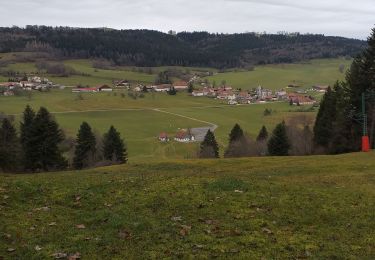
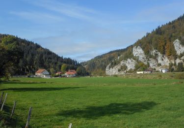
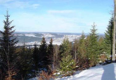
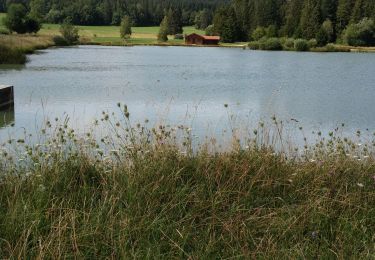
Très belle randonnée en grande partie boisée, à travers une grande variété d'essence d'arbres et d'espaces naturels : bois, prés, clairières ... que vous allez traverser tout au long de ce parcours. Vous pourrez observer la faune de ce types de milieux parfois escarpés.
Walking
Walking
Mountain bike

Bicycle tourism
Walking

Mountain bike

Other activity

Horseback riding
Mountain bike