


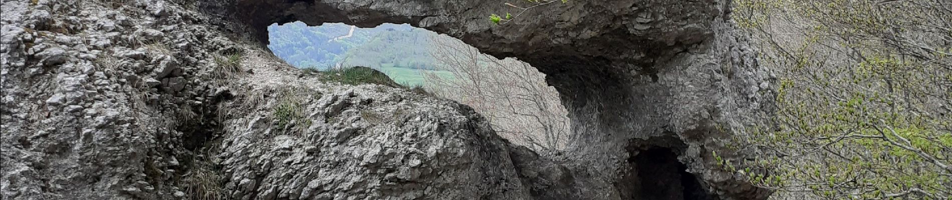
Double arche de Rucla

cousam
User


Length
3.2 km

Max alt
1404 m

Uphill gradient
185 m
Km-Effort
5.7 km

Min alt
1209 m

Downhill gradient
187 m
Boucle
Yes
Creation date :
2022-05-09 13:13:04.832
Updated on :
2022-05-09 16:16:38.928
1h05
Difficulty : Easy

FREE GPS app for hiking
 SityTrail
IGN / Geographical institutes
SityTrail Plus
The world is yours!
About
Trail Walking of 3.2 km to be discovered at Auvergne-Rhône-Alpes, Drôme, Léoncel. This trail is proposed by cousam.
Photos


Positioning
Country:
France
Region :
Auvergne-Rhône-Alpes
Department/Province :
Drôme
Municipality :
Léoncel
Location:
Unknown
Start:(Dec)
Start:(UTM)
674839 ; 4975155 (31T) N.
Comments