


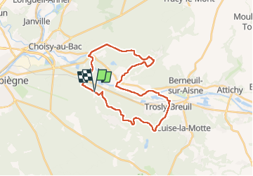
Rethondes

pmauvieux
User

Length
28 km

Max alt
133 m

Uphill gradient
394 m
Km-Effort
33 km

Min alt
31 m

Downhill gradient
401 m
Boucle
Yes
Creation date :
2022-05-07 07:09:14.644
Updated on :
2022-05-09 17:14:58.438
56h51
Difficulty : Very difficult

FREE GPS app for hiking
 SityTrail
IGN / Geographical institutes
SityTrail Plus
The world is yours!
About
Trail Walking of 28 km to be discovered at Hauts-de-France, Oise, Compiègne. This trail is proposed by pmauvieux.
Positioning
Country:
France
Region :
Hauts-de-France
Department/Province :
Oise
Municipality :
Compiègne
Location:
Unknown
Start:(Dec)
Start:(UTM)
493945 ; 5473065 (31U) N.
Comments