


tavier

lerson
User
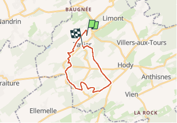

Length
10 km

Max alt
299 m

Uphill gradient
161 m
Km-Effort
12.3 km

Min alt
190 m

Downhill gradient
195 m
Boucle
No
Creation date :
2022-05-10 12:12:40.884
Updated on :
2022-05-11 07:59:06.412
2h56
Difficulty : Easy

FREE GPS app for hiking
 SityTrail
IGN / Geographical institutes
SityTrail Plus
The world is yours!
About
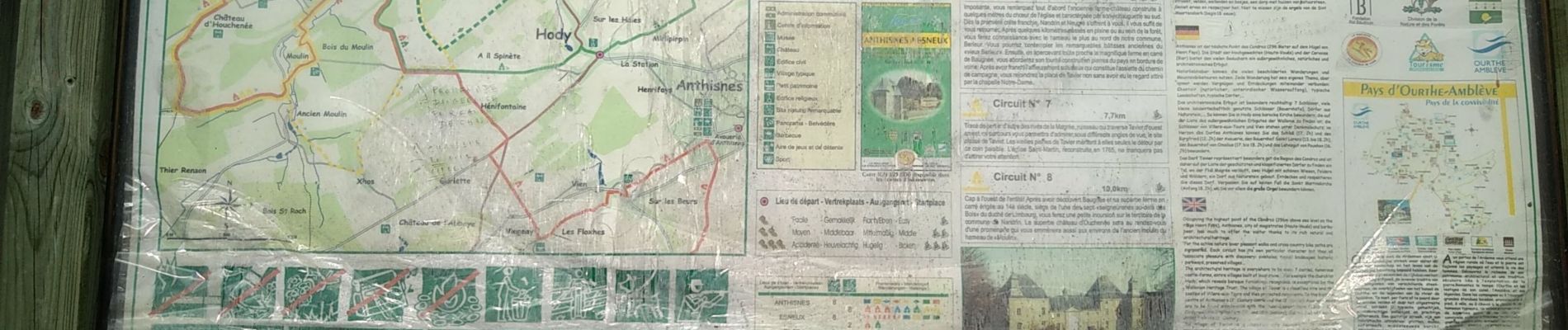
Trail Walking of 10 km to be discovered at Wallonia, Liège, Anthisnes. This trail is proposed by lerson.
Photos


Positioning
Country:
Belgium
Region :
Wallonia
Department/Province :
Liège
Municipality :
Anthisnes
Location:
Unknown
Start:(Dec)
Start:(UTM)
675442 ; 5597142 (31U) N.
Comments