


Étang du Milouga

lebarça
User
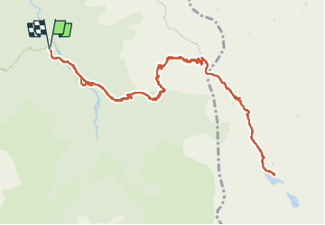

Length
16.2 km

Max alt
1992 m

Uphill gradient
1173 m
Km-Effort
32 km

Min alt
938 m

Downhill gradient
1172 m
Boucle
Yes
Creation date :
2022-05-12 06:48:34.0
Updated on :
2022-05-12 17:49:13.087
8h15
Difficulty : Medium

FREE GPS app for hiking
 SityTrail
IGN / Geographical institutes
SityTrail Plus
The world is yours!
About
Trail Walking of 16.2 km to be discovered at Occitania, Ariège, Bordes-Uchentein. This trail is proposed by lebarça.
Positioning
Country:
France
Region :
Occitania
Department/Province :
Ariège
Municipality :
Bordes-Uchentein
Location:
Les Bordes-sur-Lez
Start:(Dec)
Start:(UTM)
339056 ; 4744077 (31T) N.
Comments