


conques figeac cassagnole

lablaquiere
User
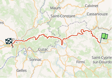

Length
54 km

Max alt
417 m

Uphill gradient
1039 m
Km-Effort
68 km

Min alt
183 m

Downhill gradient
1010 m
Boucle
No
Creation date :
2022-05-13 10:42:07.028
Updated on :
2022-05-14 06:45:52.188
5h32
Difficulty : Medium

FREE GPS app for hiking
 SityTrail
IGN / Geographical institutes
SityTrail Plus
The world is yours!
About
Trail Mountain bike of 54 km to be discovered at Occitania, Aveyron, Conques-en-Rouergue. This trail is proposed by lablaquiere.
Positioning
Country:
France
Region :
Occitania
Department/Province :
Aveyron
Municipality :
Conques-en-Rouergue
Location:
Unknown
Start:(Dec)
Start:(UTM)
452139 ; 4938600 (31T) N.
Comments