


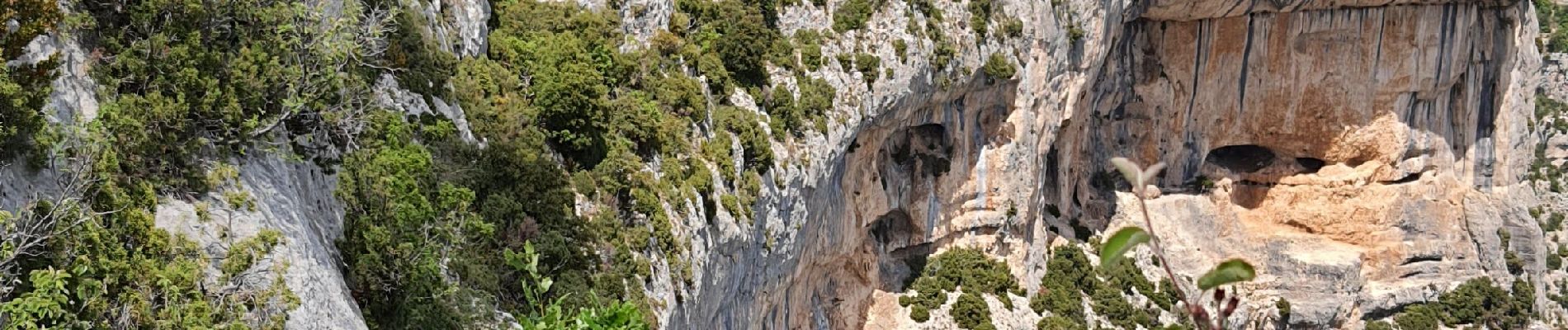
saint Hubert et le rocher de Cire

aeroseb84
User
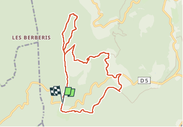

Length
10.3 km

Max alt
888 m

Uphill gradient
294 m
Km-Effort
14.3 km

Min alt
663 m

Downhill gradient
299 m
Boucle
Yes
Creation date :
2022-05-15 08:38:37.496
Updated on :
2022-05-15 12:34:18.426
3h01
Difficulty : Medium

FREE GPS app for hiking
 SityTrail
IGN / Geographical institutes
SityTrail Plus
The world is yours!
About
Trail Walking of 10.3 km to be discovered at Provence-Alpes-Côte d'Azur, Vaucluse, Monieux. This trail is proposed by aeroseb84.
Description
petite boucle dans les gorges de la Nesque
Photos


Positioning
Country:
France
Region :
Provence-Alpes-Côte d'Azur
Department/Province :
Vaucluse
Municipality :
Monieux
Location:
Unknown
Start:(Dec)
Start:(UTM)
685998 ; 4877521 (31T) N.
Comments