


VENTAVON lac de Peysier n

RobinMicheline
User GUIDE
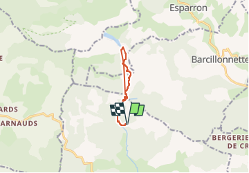

Length
9.3 km

Max alt
1324 m

Uphill gradient
552 m
Km-Effort
16.7 km

Min alt
811 m

Downhill gradient
553 m
Boucle
Yes
Creation date :
2022-05-17 06:11:26.807
Updated on :
2022-05-19 16:08:33.505
2h53
Difficulty : Medium

FREE GPS app for hiking
 SityTrail
IGN / Geographical institutes
SityTrail Plus
The world is yours!
About
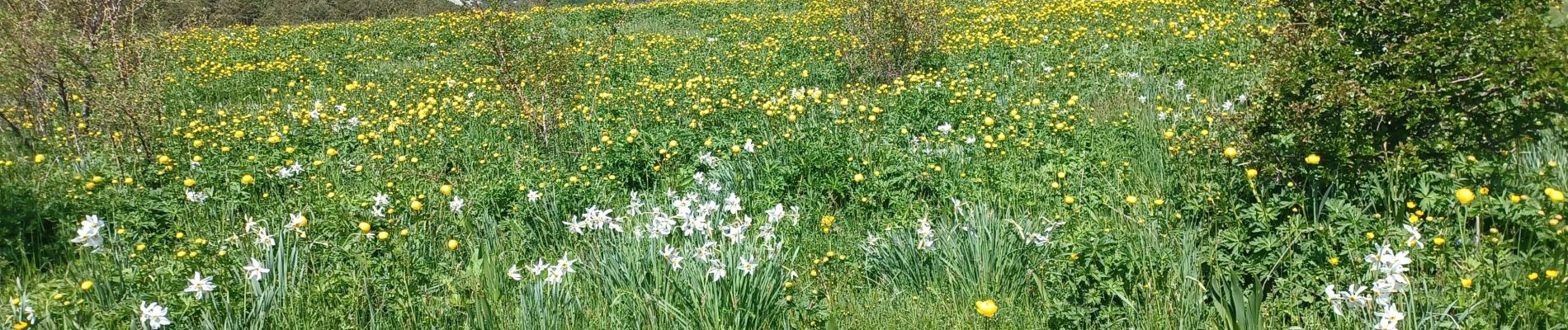
Trail Walking of 9.3 km to be discovered at Provence-Alpes-Côte d'Azur, Hautes-Alpes, Ventavon. This trail is proposed by RobinMicheline.
Photos


Positioning
Country:
France
Region :
Provence-Alpes-Côte d'Azur
Department/Province :
Hautes-Alpes
Municipality :
Ventavon
Location:
Unknown
Start:(Dec)
Start:(UTM)
728704 ; 4921626 (31T) N.
Comments