Trail Walking Aucun - SityTrail - AUCUN Couraduque  Le Berbeillet autrement G3 2976337 - Photo

SityTrail - AUCUN Couraduque Le Berbeillet autrement G3 2976337

© OpenStreetMap contributors
Length
Length
9.5 km
Max alt
Max alt
1616 m
Uphill gradient
Uphill gradient
350 m
Km-Effort
Km-Effort  
14.2 km
Min alt
Min alt
1367 m
Downhill gradient
Downhill gradient
352 m
Boucle
Boucle
Yes
Creation date :
2022-05-18 20:27:52.155
Updated on :
2022-05-19 08:41:20.554

(1 Reviews)

Walking
Walking
3h13
Difficulty : Difficult

Scan this QR Code to open this trail in the SityTrail application

FREE GPS app for hiking

Logo SityTrail SityTrail

IGN / Geographical institutes

Download SityTrail from the App Store Download SityTrail from Google Play

Logo SityTrail SityTrail Plus

The world is yours!

Download SityTrail from the App Store Download SityTrail from Google Play Download SityTrail on Huawei AppGallery

About

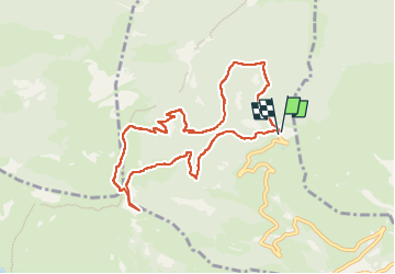
Trail Walking of 9.5 km to be discovered at Occitania, Hautespyrenees, Aucun. This trail is proposed by mitch1952.

Description

Prévoir un départ à 9h15 de la station de Couraduque pour un PN vers 12h / 12h30 au sommet du Berbeillet. (le temps de contemplation du paysage est compris)
Sachant que la reco a pris en marche effective 3h.
Une seconde reco 48 h après nous fera contourner le soum de Berducou par la droite et prendre un superbe chemin plutot que la piste .
Et cest cette derniere version qui sera retenue à lhunanimité d'une voix, le mienne

Elevation profile

Positioning

Country:
France
Region :
Occitania
Department/Province :
Hautespyrenees
Municipality :
Aucun
Location:
Unknown
Start:(UTM)
728062 ; 4763613 (30T) N.

Comments

Please log in to post a review or rate the element


Close
My subscriptions