


mp st Nabord 2022

lacote
User
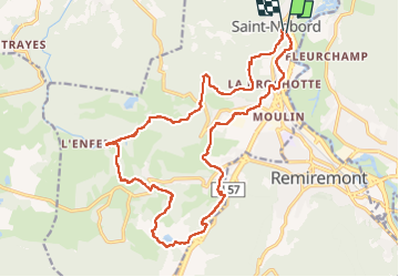

Length
21 km

Max alt
577 m

Uphill gradient
489 m
Km-Effort
27 km

Min alt
381 m

Downhill gradient
487 m
Boucle
Yes
Creation date :
2022-05-22 06:38:22.965
Updated on :
2022-05-22 11:03:36.135
3h59
Difficulty : Very difficult

FREE GPS app for hiking
 SityTrail
IGN / Geographical institutes
SityTrail Plus
The world is yours!
About
Trail Walking of 21 km to be discovered at Grand Est, Vosges, Saint-Nabord. This trail is proposed by lacote.
Photos

Positioning
Country:
France
Region :
Grand Est
Department/Province :
Vosges
Municipality :
Saint-Nabord
Location:
Unknown
Start:(Dec)
Start:(UTM)
319733 ; 5324253 (32U) N.
Comments