


GR 10 21

chasle
User
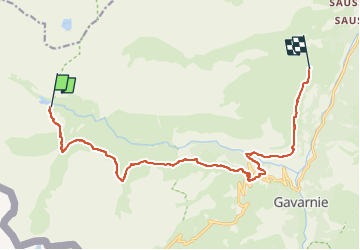

Length
14.6 km

Max alt
1966 m

Uphill gradient
556 m
Km-Effort
23 km

Min alt
1438 m

Downhill gradient
768 m
Boucle
No
Creation date :
2022-05-23 22:40:35.021
Updated on :
2022-05-23 22:41:04.647
5h09
Difficulty : Difficult

FREE GPS app for hiking
 SityTrail
IGN / Geographical institutes
SityTrail Plus
The world is yours!
About
Trail Walking of 14.6 km to be discovered at Occitania, Hautespyrenees, Gavarnie-Gèdre. This trail is proposed by chasle.
Positioning
Country:
France
Region :
Occitania
Department/Province :
Hautespyrenees
Municipality :
Gavarnie-Gèdre
Location:
Gavarnie
Start:(Dec)
Start:(UTM)
737711 ; 4737861 (30T) N.
Comments