


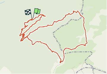
Pas de PILLOUSE et des BACHASSONS Hauts plateaux

TOULAUDIN
User

Length
16.9 km

Max alt
1677 m

Uphill gradient
853 m
Km-Effort
28 km

Min alt
1004 m

Downhill gradient
850 m
Boucle
Yes
Creation date :
2022-05-22 07:38:37.518
Updated on :
2022-06-03 11:21:13.083
7h00
Difficulty : Difficult

FREE GPS app for hiking
 SityTrail
IGN / Geographical institutes
SityTrail Plus
The world is yours!
About
Trail Walking of 16.9 km to be discovered at Auvergne-Rhône-Alpes, Drôme, Romeyer. This trail is proposed by TOULAUDIN.
Description
trace rando réalisée avec club ASPTT Valence
Positioning
Country:
France
Region :
Auvergne-Rhône-Alpes
Department/Province :
Drôme
Municipality :
Romeyer
Location:
Unknown
Start:(Dec)
Start:(UTM)
693487 ; 4964384 (31T) N.
Comments