


Refugio Duc dei Abruzzes

GOHIER
User
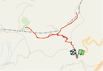

Length
6.7 km

Max alt
2410 m

Uphill gradient
421 m
Km-Effort
12.3 km

Min alt
2129 m

Downhill gradient
420 m
Boucle
Yes
Creation date :
2022-05-24 07:58:08.0
Updated on :
2022-05-24 12:10:39.104
4h11
Difficulty : Medium

FREE GPS app for hiking
 SityTrail
IGN / Geographical institutes
SityTrail Plus
The world is yours!
About
Trail Walking of 6.7 km to be discovered at Abruzzo, L'Aquila, L'Aquila. This trail is proposed by GOHIER.
Description
Joli parcours en crête, parfois impressionnant. Hélas, vent pénible.
Très beaux paysages du Gran Sasso.
Positioning
Country:
Italy
Region :
Abruzzo
Department/Province :
L'Aquila
Municipality :
L'Aquila
Location:
Unknown
Start:(Dec)
Start:(UTM)
381423 ; 4699941 (33T) N.
Comments