


La Hourquette d'Alans

mitch1952
User
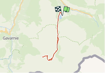

Length
14.9 km

Max alt
2446 m

Uphill gradient
823 m
Km-Effort
26 km

Min alt
1658 m

Downhill gradient
828 m
Boucle
Yes
Creation date :
2022-05-25 15:22:15.584
Updated on :
2022-05-25 15:28:45.319
5h53
Difficulty : Very difficult

FREE GPS app for hiking
 SityTrail
IGN / Geographical institutes
SityTrail Plus
The world is yours!
About
Trail Walking of 14.9 km to be discovered at Occitania, Hautespyrenees, Gavarnie-Gèdre. This trail is proposed by mitch1952.
Description
IBP 105 Cotation : E5 T3 R3


Positioning
Country:
France
Region :
Occitania
Department/Province :
Hautespyrenees
Municipality :
Gavarnie-Gèdre
Location:
Gèdre
Start:(Dec)
Start:(UTM)
258723 ; 4737406 (31T) N.
Comments