


La haute Faude. Wirwignes

tenace
User
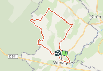

Length
8.8 km

Max alt
94 m

Uphill gradient
121 m
Km-Effort
10.4 km

Min alt
26 m

Downhill gradient
121 m
Boucle
Yes
Creation date :
2022-05-26 14:04:26.101
Updated on :
2022-05-26 22:53:34.59
2h06
Difficulty : Medium

FREE GPS app for hiking
 SityTrail
IGN / Geographical institutes
SityTrail Plus
The world is yours!
About
Trail Walking of 8.8 km to be discovered at Hauts-de-France, Pas-de-Calais, Wirwignes. This trail is proposed by tenace.
Description
Randonnée
Positioning
Country:
France
Region :
Hauts-de-France
Department/Province :
Pas-de-Calais
Municipality :
Wirwignes
Location:
Unknown
Start:(Dec)
Start:(UTM)
412484 ; 5615474 (31U) N.
Comments