Trail Walking Oberkirch - Bonjour, 
Si on utilise la fonction fichier pour mettre des pdf dans une page, avec un seul ça va, mais avec deux ça ne fonctionne plus...
Xavier Chamagne  - Photo

Bonjour, Si on utilise la fonction fichier pour mettre des pdf dans une page, avec un seul ça va, mais avec deux ça ne fonctionne plus... Xavier Chamagne

 xc
xc

User

© OpenStreetMap contributors
Length
Length
10.3 km
Max alt
Max alt
433 m
Uphill gradient
Uphill gradient
294 m
Km-Effort
Km-Effort  
14.2 km
Min alt
Min alt
315 m
Downhill gradient
Downhill gradient
301 m
Boucle
Boucle
Yes
Creation date :
2022-05-28 09:09:43.855
Updated on :
2022-05-28 13:40:20.652

(0 Reviews)

Walking
Walking
2h44
Difficulty : Difficult

Scan this QR Code to open this trail in the SityTrail application

FREE GPS app for hiking

Logo SityTrail SityTrail

IGN / Geographical institutes

Download SityTrail from the App Store Download SityTrail from Google Play

Logo SityTrail SityTrail World

The world is yours!

Download SityTrail from the App Store Download SityTrail from Google Play Download SityTrail on Huawei AppGallery

About

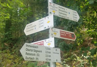
Trail Walking of 10.3 km to be discovered at Baden-Württemberg, Ortenaukreis, Oberkirch. This trail is proposed by xc.

Elevation profile

Positioning

Country:
Germany
Region :
Baden-Württemberg
Department/Province :
Ortenaukreis
Municipality :
Oberkirch
Location:
Unknown
Start:(UTM)
429499 ; 5371597 (32U) N.

Trails nearby

Trail On foot Durbach - Genießerpfad - Gebirger Höfe-Weg - Photo
On foot
PRO

On foot

Easy
Durbach, Baden-Württemberg, Ortenaukreis, Germany
11.4 km | 18.2 km-effort
4h 8min
No
Trail On foot Lautenbach - Lautenbacher Hexensteig - Photo
On foot
PRO

On foot

Medium
Lautenbach, Baden-Württemberg, Ortenaukreis, Germany
14.9 km | 23 km-effort
5h 18min
Yes
Trail On foot Durbach - Durbachtalweg - Photo
On foot
PRO

On foot

Easy
Durbach, Baden-Württemberg, Ortenaukreis, Germany
5.2 km | 6.7 km-effort
1h 30min
No
Trail Walking Oberkirch - 2024 - Oberkirch Brennersteig  - Photo
Walking
dragonfr67

Walking

Very difficult
Oberkirch, Baden-Württemberg, Ortenaukreis, Germany
14 km | 20 km-effort
4h 36min
Yes
Trail On foot Oberkirch - SWV-Wegstücke mit gelben Rauten - Photo
On foot
PRO

On foot

Easy
Oberkirch, Baden-Württemberg, Ortenaukreis, Germany
6 km | 9.5 km-effort
2h 9min
No
Trail Walking Oberkirch - bottenau _ staufengerg - Photo
Walking
mijuclo

Walking

Easy
Oberkirch, Baden-Württemberg, Ortenaukreis, Germany
9.5 km | 13.3 km-effort
2h 14min
Yes
Trail Walking Ohlsbach - xc 240407 mooskopf paola - Photo
Walking
xc

Walking

Very difficult
Ohlsbach, Baden-Württemberg, Ortenaukreis, Germany
15 km | 22 km-effort
5h 25min
Yes
Trail Walking Durbach - xc 240317 durbach paola oksana - Photo
Walking
xc

Walking

Difficult
Durbach, Baden-Württemberg, Ortenaukreis, Germany
11.3 km | 16.3 km-effort
4h 35min
Yes
Trail Walking Lautenbach - Oberkirch Sentier sorcière  - Photo
Walking
pmauvieux

Walking

Very difficult
Lautenbach, Baden-Württemberg, Ortenaukreis, Germany
15.9 km | 24 km-effort
4h 7min
Yes


Close
My subscriptions