


Pastourelle 2022

robertserre
User
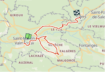

Length
16.7 km

Max alt
950 m

Uphill gradient
816 m
Km-Effort
27 km

Min alt
638 m

Downhill gradient
513 m
Boucle
No
Creation date :
2022-05-28 08:20:33.0
Updated on :
2022-05-28 13:59:25.528
3h51
Difficulty : Very difficult

FREE GPS app for hiking
 SityTrail
IGN / Geographical institutes
SityTrail Plus
The world is yours!
About
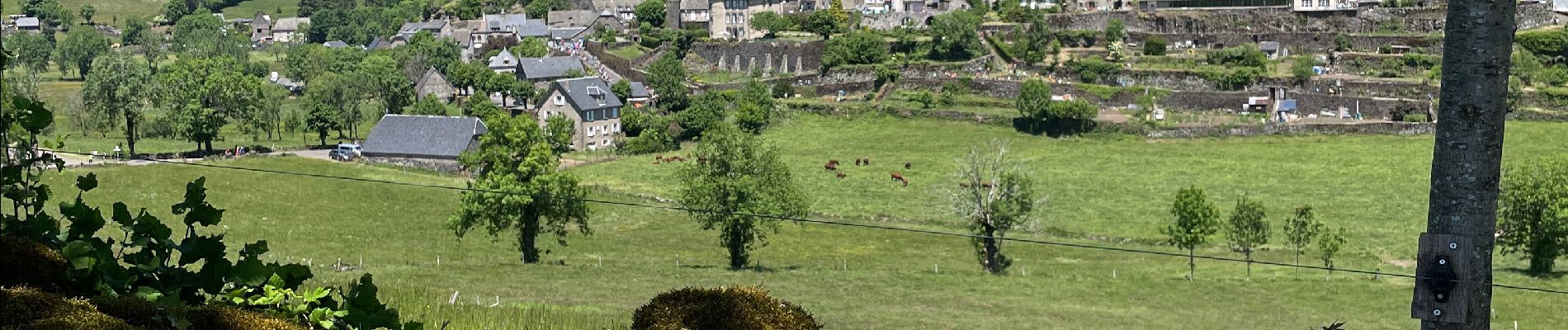
Trail Walking of 16.7 km to be discovered at Auvergne-Rhône-Alpes, Cantal, Saint-Martin-Valmeroux. This trail is proposed by robertserre.
Photos


Positioning
Country:
France
Region :
Auvergne-Rhône-Alpes
Department/Province :
Cantal
Municipality :
Saint-Martin-Valmeroux
Location:
Saint-Martin-Valmeroux
Start:(Dec)
Start:(UTM)
454984 ; 4996039 (31T) N.
Comments