


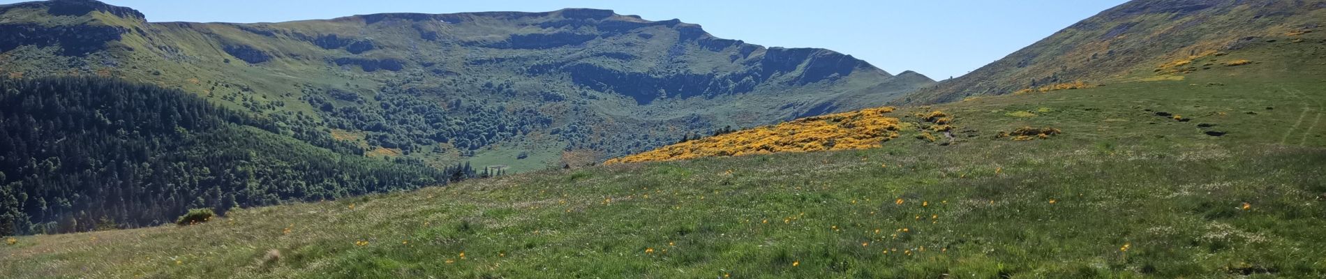
col de Molede cirque de Chamalières

bidetarou
User
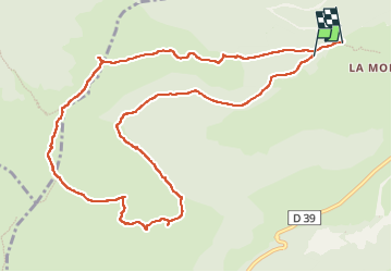

Length
12.2 km

Max alt
1801 m

Uphill gradient
589 m
Km-Effort
20 km

Min alt
1333 m

Downhill gradient
617 m
Boucle
No
Creation date :
2022-05-28 09:24:36.138
Updated on :
2022-05-28 15:24:45.986
5h58
Difficulty : Very difficult

FREE GPS app for hiking
 SityTrail
IGN / Geographical institutes
SityTrail Plus
The world is yours!
About
Trail Walking of 12.2 km to be discovered at Auvergne-Rhône-Alpes, Cantal, Albepierre-Bredons. This trail is proposed by bidetarou.
Description
Randonnée débutant par une partie ombragée puis montée vers les crêtes autour du cirques de Chamalières. Prévoir du temps parties difficiles au niveau du puy du rocher (échelle métallique)
Photos


Positioning
Country:
France
Region :
Auvergne-Rhône-Alpes
Department/Province :
Cantal
Municipality :
Albepierre-Bredons
Location:
Unknown
Start:(Dec)
Start:(UTM)
485036 ; 4992201 (31T) N.
Comments