


le lac des salettes mormoiron

fernandezyvan
User
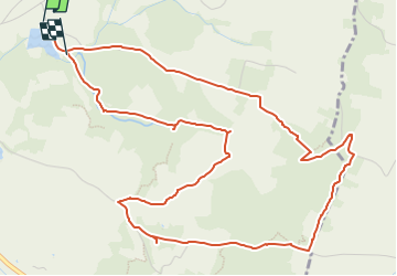

Length
7.2 km

Max alt
356 m

Uphill gradient
187 m
Km-Effort
9.7 km

Min alt
240 m

Downhill gradient
184 m
Boucle
No
Creation date :
2022-05-31 16:32:27.156
Updated on :
2022-05-31 16:34:29.704
2h11
Difficulty : Easy

FREE GPS app for hiking
 SityTrail
IGN / Geographical institutes
SityTrail Plus
The world is yours!
About
Trail On foot of 7.2 km to be discovered at Provence-Alpes-Côte d'Azur, Vaucluse, Mormoiron. This trail is proposed by fernandezyvan.
Description
petite randonnée avant le pique nique de fin d'année
Positioning
Country:
France
Region :
Provence-Alpes-Côte d'Azur
Department/Province :
Vaucluse
Municipality :
Mormoiron
Location:
Unknown
Start:(Dec)
Start:(UTM)
675782 ; 4882045 (31T) N.
Comments