Trail Mountain bike Parcy-et-Tigny - asso 14/18 - Photo
 hm
hm

User

© OpenStreetMap contributors
Length
Length
33 km
Max alt
Max alt
248 m
Uphill gradient
Uphill gradient
659 m
Km-Effort
Km-Effort  
42 km
Min alt
Min alt
77 m
Downhill gradient
Downhill gradient
643 m
Boucle
Boucle
No
Creation date :
2014-12-10 00:00:00.0
Updated on :
2014-12-10 00:00:00.0

(0 Reviews)

Mountain bike
Mountain bike
3h00
Difficulty : Medium

Scan this QR Code to open this trail in the SityTrail application

FREE GPS app for hiking

Logo SityTrail SityTrail

IGN / Geographical institutes

Download SityTrail from the App Store Download SityTrail from Google Play

Logo SityTrail SityTrail World

The world is yours!

Download SityTrail from the App Store Download SityTrail from Google Play Download SityTrail on Huawei AppGallery

About

Trail Mountain bike of 33 km to be discovered at Hauts-de-France, Aisne, Parcy-et-Tigny. This trail is proposed by hm.

Elevation profile

Positioning

Country:
France
Region :
Hauts-de-France
Department/Province :
Aisne
Municipality :
Parcy-et-Tigny
Location:
Unknown
Start:(UTM)
525452 ; 5457071 (31U) N.

Trails nearby

Trail Car Grand-Rozoy - essai  - Photo
Car
willaumef

Car

Very easy
Grand-Rozoy, Hauts-de-France, Aisne, France
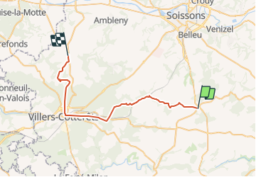
24 km | 27 km-effort
2h 28min
No
Trail Other activity Parcy-et-Tigny - asso 14/18 - Photo
Other activity
hm

Other activity

Medium
Parcy-et-Tigny, Hauts-de-France, Aisne, France
33 km | 42 km-effort
3h 0min
No


Close
My subscriptions