


Chartreuse tour du Charmant Son

c.gourme
User

Length
15.1 km

Max alt
1747 m

Uphill gradient
931 m
Km-Effort
27 km

Min alt
935 m

Downhill gradient
935 m
Boucle
Yes
Creation date :
2022-06-02 06:30:46.0
Updated on :
2022-06-04 19:22:17.067
6h03
Difficulty : Difficult

FREE GPS app for hiking
 SityTrail
IGN / Geographical institutes
SityTrail Plus
The world is yours!
About
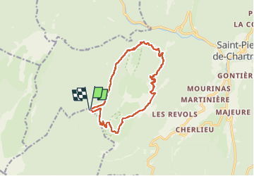
Trail Walking of 15.1 km to be discovered at Auvergne-Rhône-Alpes, Isère, Saint-Pierre-de-Chartreuse. This trail is proposed by c.gourme.
Description
Attention à partir du habert de la Malamille bien suivre les Kernes lors de lamontée vers le Collet
Positioning
Country:
France
Region :
Auvergne-Rhône-Alpes
Department/Province :
Isère
Municipality :
Saint-Pierre-de-Chartreuse
Location:
Unknown
Start:(Dec)
Start:(UTM)
714757 ; 5022376 (31T) N.
Comments