


30 Chamborigaud pic de la Tourette

HAL26
User
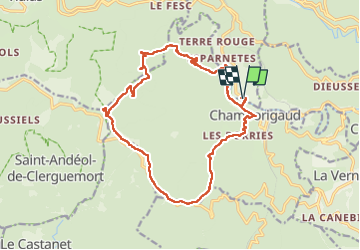

Length
19 km

Max alt
894 m

Uphill gradient
676 m
Km-Effort
28 km

Min alt
293 m

Downhill gradient
678 m
Boucle
Yes
Creation date :
2022-06-04 04:39:00.081
Updated on :
2022-06-04 10:43:31.631
4h53
Difficulty : Medium

FREE GPS app for hiking
 SityTrail
IGN / Geographical institutes
SityTrail Plus
The world is yours!
About
Trail Walking of 19 km to be discovered at Occitania, Gard, Génolhac. This trail is proposed by HAL26.
Positioning
Country:
France
Region :
Occitania
Department/Province :
Gard
Municipality :
Génolhac
Location:
Unknown
Start:(Dec)
Start:(UTM)
577425 ; 4906554 (31T) N.
Comments